Looking for room to breathe near Montague, where woods, water, and quiet roads meet small-city convenience? Buying land can unlock a hobby farm, future build site, or a simple weekend retreat, but vacant parcels come with rules and checks that homes on city lots rarely face. In this guide, you’ll learn how to confirm zoning, utilities, access, soils, and environmental overlays before you write an offer. You’ll also get a practical checklist and links to local tools so you can move forward confidently. Let’s dive in.
Why buy land around Montague
You get the best of both worlds. Inside the City of Montague, you’ll find municipal water and sewer plus walkable access to everyday needs. Step just outside city limits and you’ll see larger parcels, mixed woodlands, and fields that suit privacy, recreation, or small-scale agriculture. The area’s proximity to White Lake and Lake Michigan adds lifestyle value, but shoreline-adjacent sites require extra due diligence. The key is knowing how the rules change from parcel to parcel.
Start smart: confirm jurisdiction and zoning
Your first task is to find out which government controls the parcel, because that determines the zoning rules.
Use the county GIS viewer
- Open the Muskegon County GIS/Zoning Viewer to confirm parcel lines, the controlling jurisdiction, zoning category, and overlay layers like floodplain, wetlands, and critical dunes. The viewer is your map-based starting point. Use the zoning legend to understand what each layer means. Muskegon County GIS/Zoning Viewer
Know the zoning basics
- Zoning determines permitted uses, minimum lot sizes, setbacks, and frontage rules. Inside the city, Montague’s master plan and zoning framework guide future development. If you are considering a split or a use beyond single-family, verify allowable uses with the zoning administrator before moving forward. For citywide planning context and references to flood overlays and utilities, review the City of Montague Master Plan. City of Montague Master Plan
Watch special overlays
- Natural River corridor: Parts of the White River carry Natural River protections, which often create a regulated corridor from the river’s edge and limit development near the water. Always confirm whether your parcel lies in this corridor. White River Natural River rule
- Critical Dune Areas: Parcels near Lake Michigan and White Lake may fall within Critical Dune Areas, where state review and permits are required for many land-disturbing activities. Treat mapped dunes as a red flag for added design and permitting steps. EGLE Critical Dunes overview
- Floodplain overlays: Mapped FEMA flood zones trigger elevation, insurance, and building requirements. Montague’s planning documents adopt floodplain overlays that you should factor into costs and design. Use the county GIS viewer to see local flood layers and consult FEMA maps for the specific address.
Water and sewer: is a main nearby?
Inside the City of Montague and some nearby areas, municipal water and sanitary sewer serve properties, and local rules require you to connect when a main is available. Do not assume a stub is at the lot line. Contact the City of Montague Department of Public Works to confirm the nearest main, current connection requirements, and any special rules near wellhead protection areas. The city’s master plan also notes the municipal system details and regional interconnections. City of Montague Master Plan
If the parcel is outside service areas, plan for a private well and on-site sewage disposal. Budget for drilling, testing, and septic design early in your process.
Septic and well basics in Muskegon County
Most rural parcels around Montague rely on a private well and a septic system. Muskegon County Public Health is your central contact for permits, soil evaluations, and records.
- Start with the county’s program page to understand required applications, site inspections, and available records for existing systems. Muskegon County Public Health: Septic & Well
- The county’s permit form lists fees, typical processing times, included water tests, and isolation distances between wells, septic fields, and other features. Plan for at least a short lead time and schedule soil pits during workable ground conditions. County Well/Septic Permit Form and Fees
- Michigan health departments rely on a full soil/site evaluation rather than a simple perc test. Expect test pits, groundwater depth checks, and layout constraints.
- Challenging soils or shallow water tables can require engineered or alternative septic systems. Regional guidance shows engineered systems often add 10,000 to 20,000 dollars or more over conventional systems. Build that contingency into your budget for parcels with hydric or poorly drained soils. Engineered septic cost overview
Pro tip: If you are buying a parcel with an existing system, ask Public Health for any records or evaluations so you understand age, type, and past permits before closing.
Screen soils, wetlands, and flood risk early
An early desktop screen can save you time and avoid costly surprises.
- County GIS: Turn on wetlands, floodplain, and other overlays to see red flags before you visit the site. Muskegon County GIS/Zoning Viewer
- Soils: Use the USDA NRCS Web Soil Survey to check mapped soil types, drainage class, slopes, and potential limitations. Treat these maps as a starting point and verify with a county soil evaluation.
- State permits: If the parcel includes or borders regulated wetlands, lakes/streams, shoreland, or critical dunes, you may need a state permit through EGLE’s Joint Permit process. Complex projects can take months and may require mitigation or design changes. EGLE Joint Permit Application guidance
- Natural River corridors and critical dunes: For riparian or dune-adjacent parcels, confirm boundaries and rules before spending on design. Natural River rule • Critical Dunes overview
Signs you may need extra review include seasonal standing water, saturated soils in spring, or wooded lowland vegetation across much of the site. If you see these in person, pause and confirm your path with the county and EGLE before proceeding.
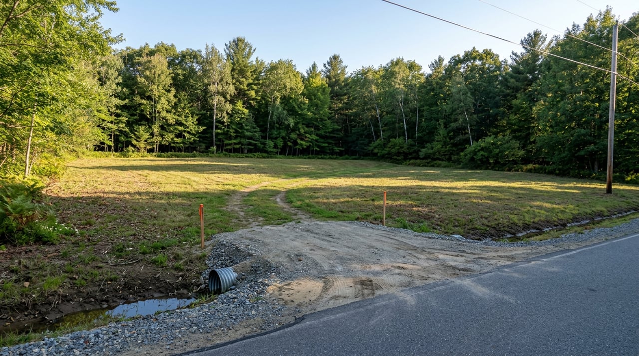
Access, driveways, and private roads
Access affects safety, maintenance, and financing.
- Road type: Confirm whether the frontage is a public road maintained by the county, a city street, or a private road governed by a recorded maintenance agreement. Private roads without a recorded agreement can create financing and maintenance issues.
- Driveway permits: New driveways that connect to county roads require a permit and inspection for sight distance and drainage. Apply early if you plan to cut a new approach or widen an existing one. Muskegon County Road Commission permits
- Easements and encumbrances: Pull the recorded documents for the parcel to verify access easements, utility easements, conservation restrictions, and any private road agreements. These can influence where you build and how you use the land. Muskegon County Register of Deeds
If a parcel appears landlocked, confirm there is a legal, recorded access easement in place and that its location fits your intended driveway alignment.
Power, gas, and broadband
Electric service in much of Muskegon County is provided by Consumers Energy, and natural gas service is commonly provided by DTE in many areas. Not every rural parcel has a nearby gas main, so plan for propane or other alternatives if needed. Always confirm service availability and any connection costs with the utility and the local jurisdiction.
Broadband varies by address. In-town parcels often have cable or fiber options, while rural addresses may rely on fixed wireless or satellite. If wired providers are not present at your target parcel, check cellular coverage or satellite plans as a backup.
A practical parcel checklist
Use these steps to evaluate a specific parcel around Montague:
- Identify jurisdiction and zoning. Use the county GIS to confirm parcel ID, controlling jurisdiction, zoning category, and overlay layers for wetlands, floodplain, critical dunes, and Natural River corridors. Muskegon County GIS/Zoning Viewer
- Pull recorded documents. Search the Register of Deeds for easements, covenants, prior permits, and any environmental restrictions that could affect buildability. Register of Deeds
- Check flood overlays and local rules. If any portion appears in a mapped flood zone, plan for elevation, floodproofing, or adjusted building footprints. Review the city’s planning documents for floodplain overlays. Montague Master Plan
- Screen soils. Use NRCS Web Soil Survey to review soil types, drainage, and slope. Treat results as preliminary and schedule a site evaluation if you intend to build.
- Contact Public Health. Request any existing septic records and initiate a soil/site evaluation for a new system. Review the county permit form for fees, isolation distances, and processing timelines. Septic & Well program • Permit form
- Confirm water and sewer. Ask the City of Montague DPW about the nearest mains and any mandatory connection rules. If no mains are nearby, plan for well and septic.
- Plan access. Verify road type and apply early for a county driveway permit if you need a new approach. Confirm any private road agreements in the recorded documents. Road Commission permits
- Determine state permit needs. If wetlands, streams, shorelines, or dunes are involved, review EGLE’s Joint Permit guidance and consider a pre-application conversation. EGLE Joint Permit guidance
- Build a realistic budget. Include well drilling and testing, septic design and installation, contingencies for engineered systems, driveway and culvert work, and potential EGLE permit costs or mitigation. Engineered septic cost reference
Budget and timeline planning
Even a straightforward rural build needs time for evaluations and permits. County forms note a minimum processing lead time for well and septic permits, and you should plan for several weeks from soil evaluation to system approval. If your site needs an engineered septic, add time for design and bidding. State permits tied to wetlands, shorelines, or dunes can add months.
When you pencil out the numbers, include:
- County permit fees and soil/site evaluation costs.
- Well drilling, pump, pressure tank, and initial water testing.
- Septic system components and a contingency for engineered alternatives.
- Driveway improvements, culvert, and the driveway permit.
- Survey updates or staking for driveway and building corners.
- Potential EGLE review fees and mitigation requirements.
A clear timeline and budget keep you in control and help your builder and lenders set expectations.
How a local guide helps
You do not need to navigate all of this alone. A local agent who handles land and acreage can help you read zoning maps, coordinate with the county, flag red-flag overlays early, and line up the right evaluators. You get a smoother path from “interesting listing” to a confident, buildable purchase. When you are ready to talk through parcels around White Lake, Whitehall, Montague Township, or nearby townships, reach out and let’s build a plan.
Ready to find the right parcel and avoid costly surprises? Contact Tricia Carlson for a free neighborhood market consultation.
FAQs
What should I check first when buying vacant land near Montague?
- Start with the Muskegon County GIS/Zoning Viewer to confirm jurisdiction, zoning, and overlays. Then pull recorded easements and request Public Health records before scheduling a soil/site evaluation.
How do I know if city water or sewer is available at my lot?
- Inside the City of Montague and some nearby areas, mains are present and connection is required when available. Confirm exact main locations and connection rules with the City of Montague DPW and review the city master plan for system context.
Who handles septic and well permits in Muskegon County, and how long does it take?
- Muskegon County Public Health issues permits and performs soil/site evaluations. The permit form outlines fees and typical processing times. Plan for at least several weeks and longer if an engineered system is required.
What are Natural River, Critical Dune, and floodplain overlays, and why do they matter?
- These overlays restrict where and how you can build. Natural River corridors protect riverbanks, Critical Dune Areas regulate dune disturbance, and floodplains trigger elevation and insurance requirements. Always verify overlays before you design or buy.
Do I need a driveway permit to access a county road?
- Yes. New or modified driveways connecting to county roads require a permit and inspection for sight distance and drainage. Apply with the Muskegon County Road Commission early in your planning.
Is natural gas or broadband available on rural acreage around Montague?
- Electric service is common, but natural gas does not reach every rural parcel. Confirm availability with utilities and be ready to use propane if needed. Broadband varies by address; if cable or fiber is not available, consider fixed wireless, cellular-based options, or satellite.